Stretching 266 kilometers from the city of Livingston, Montana, to the city of Dubois, Wyoming, and 97 kilometers in width from Beartooth Overlook Lake in the eastern part of Yellowstone National Park to the Buffalo Bill Dam in Wyoming, the Absaroka Mountains are one of several mountain ranges in the state.
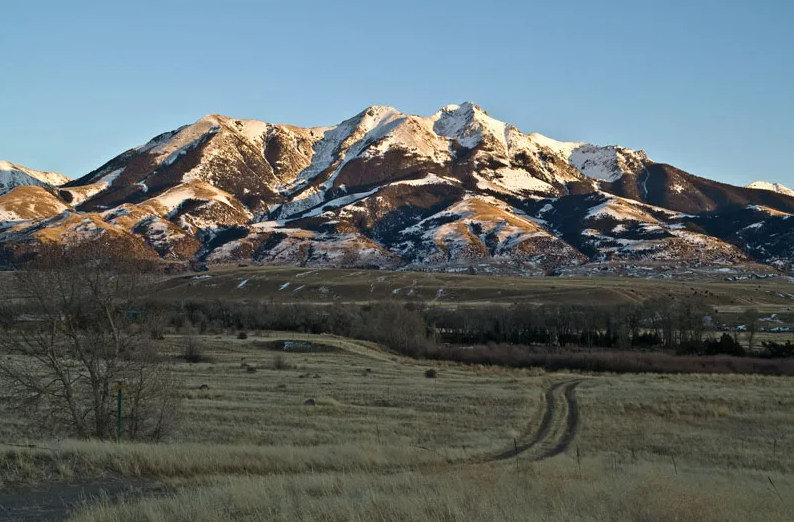
Their geographical location forms the eastern boundary of Yellowstone Park, where visitors can admire the views of their snow-covered peaks, 46 of which are over 3.7 kilometers high, with the highest peak, Franks Peak, reaching 4 kilometers.
Some of the mountain ranges are located within the park, including Washburn Peak, the most visited mountain in Yellowstone Park, and Eagle Peak, its highest summit.
Today, the Absaroka Mountains are just remnants of a once vast volcanic field known as the Absaroka Volcanic Province. The volcanic origin of the range was determined early on during its study, and it was eventually found that the total volume of erupted material exceeded 29,000 cubic kilometers. This is several times larger than the total volume of material erupted by the Yellowstone volcanic plateau throughout its existence.

For a long time, geologists considered the Absaroka volcanism to be part of the Yellowstone volcanism. The boundary between the two provinces was established as a result of productive research in the 1950s, which showed that the volcanoes of the range were active 50 million years before the start of activity of the Yellowstone hotspot in the region. Today, their period of activity is estimated to have occurred between 53 and 43 million years ago, a time when the uplift of the Rocky Mountains had already occurred, but tens of millions of years remained before the arrival of the hotspot to its current location.
The first and most significant difference between the Absaroka and Yellowstone volcanism lies in their distinctly different topography. Yellowstone is a caldera-forming volcanic system, where surface subsidence, ash deposits, and the prevalence of lava flows contributed to the formation of spacious and relatively flat landscapes. The Absaroka Mountains, on the other hand, are an example of a classic volcanic arc consisting of several ancient active centers, where lava flows, solidified magma, and overlying sedimentary rocks underwent erosion processes that lasted tens of millions of years. It can be confidently said that many of the present-day peaks of the Absaroka are remnants of long-eroded volcanoes by wind, water, and ice.
The difference in the topography and altitude of the Absaroka and Yellowstone mountains directly affects the attention paid to both geological provinces. The lower elevation and gentle relief of Yellowstone have made it a much more convenient and accessible place for various studies, while scientists studying the Absaroka Mountains have had to deal with a hostile environment typical of many mountain ranges in the world. In addition to natural barriers to research, a large portion of the Absaroka is designated as a wilderness area under American law, where the construction of roads is prohibited, and low-altitude flights are only allowed in case of emergencies. Adding to the fact that the volcanoes of the range ceased to erupt over 40 million years ago, it becomes evident why all the attention belongs to Yellowstone.
Among the other unsolved mysteries of the Absaroka Mountains is the puzzle of their origin. The chemical composition of the lavas and ashes of this range allows it to be classified as volcanic arcs at the boundaries of tectonic plates, where one plate is subducting beneath another. However, the Absaroka Mountains are located nearly 1000 miles away from the nearest subduction zone, too far to have been formed in this way.